Geolocate

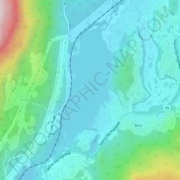
Alta Lake topographic map

Click on the map to display elevation.

Alta Lake

Originally named Summit Lake, Alta Lake was renamed to avoid confusion with the many other Summit Lakes in British Columbia. The name is derived from the Spanish for "high up" or "upper". The lake's southern end is the divide between the basins of the Green and Cheakamus Rivers. The lake is 642 metres (2,106 ft) in elevation and approximately 1.1 km2 (0.42 sq mi) in area and 2.2 kilometres (1.4 mi) north to south, with a maximum width of about 675 metres (2,215 ft), east to west.

Wikipedia (CC-BY-SA 3.0)

About this map

Name: Alta Lake topographic map, elevation, terrain.

Location: Alta Lake, Whistler Creekside, Whistler Village, Whistler, Squamish-Lillooet Regional District, British Columbia, Canada (50.10374 -122.98944 50.12280 -122.97481)

Average elevation: 726 m

Minimum elevation: 629 m

Maximum elevation: 1,148 m

Gear up for your next adventure:

🥾Trekking Poles - Poles to improve stability on uneven terrain
🖼️Topographic Map Art - Decorative 3D-effect posters of famous UK peaks and regions
🔦LED Camping Lanterns - Illumination for reading maps inside your tent at night
🛰️Outdoor GPS Navigation - Navigation devices for remote and off-grid areas
🛰️Handheld GPS Devices - Reliable GPS units for hiking and outdoor navigation

As an Amazon Associate, this site earns from qualifying purchases at no extra cost to you.