
Thank you for supporting this site ❤️
Make a donation
Make a donation
Gear up for your next adventure:
As an Amazon Associate, this site earns from qualifying purchases at no extra cost to you.
Magapit topographic map
Click on the map to display elevation.
Thank you for supporting this site ❤️
Make a donation
Make a donation
Gear up for your next adventure:
As an Amazon Associate, this site earns from qualifying purchases at no extra cost to you.
About this map
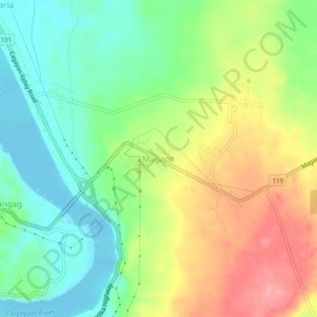
Name: Magapit topographic map, elevation, terrain.
Location: Magapit, Lal-lo, Cagayan, Cagayan Valley, 3509, Philippines (18.10810 121.66434 18.14810 121.70434)
Average elevation: 45 m
Minimum elevation: -2 m
Maximum elevation: 109 m
Thank you for supporting this site ❤️
Make a donation
Make a donation
Gear up for your next adventure:
As an Amazon Associate, this site earns from qualifying purchases at no extra cost to you.