
Onstwedde topographic map
Interactive map
Click on the map to display elevation.
About this map
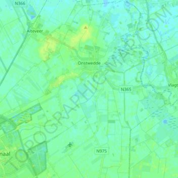
Name: Onstwedde topographic map, elevation, terrain.
Location: Onstwedde, Stadskanaal, Groningen, Netherlands (52.98068 6.96653 53.06728 7.10008)
Average elevation: 4 m
Minimum elevation: -1 m
Maximum elevation: 10 m
Other topographic maps
Click on a map to view its topography, its elevation and its terrain.