
Gletterens topographic map
Interactive map
Click on the map to display elevation.
About this map
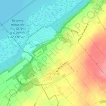
Name: Gletterens topographic map, elevation, terrain.
Location: Gletterens, District de la Broye, Fribourg, 1544, Switzerland (46.88879 6.92142 46.91250 6.94970)
Average elevation: 464 m
Minimum elevation: 422 m
Maximum elevation: 523 m
Other topographic maps
Click on a map to view its topography, its elevation and its terrain.
Forel
Switzerland > Fribourg > District de la Broye > Estavayer > Vernay > Forel
Average elevation: 458 m