
Cadolzburg topographic map
Interactive map
Click on the map to display elevation.
About this map
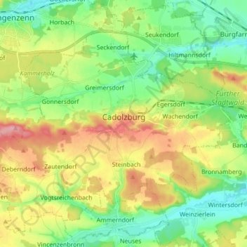
Name: Cadolzburg topographic map, elevation, terrain.
Location: Cadolzburg, Landkreis Fürth, Bayern, 90556, Deutschland (49.41719 10.77882 49.49612 10.91603)
Average elevation: 346 m
Minimum elevation: 300 m
Maximum elevation: 420 m
Der Ort liegt etwa acht Kilometer westlich von Fürth. Die Topographie weist beträchtliche Höhenunterschiede auf.