
Thank you for supporting this site ❤️
Make a donation
Make a donation
Gear up for your next adventure:
As an Amazon Associate, this site earns from qualifying purchases at no extra cost to you.
Dänkritz topographic map
Click on the map to display elevation.
Thank you for supporting this site ❤️
Make a donation
Make a donation
Gear up for your next adventure:
As an Amazon Associate, this site earns from qualifying purchases at no extra cost to you.
About this map
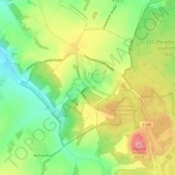
Name: Dänkritz topographic map, elevation, terrain.
Location: Dänkritz, Neukirchen/Pleiße, Zwickau, Sachsen, Deutschland (50.76631 12.40767 50.78438 12.43060)
Average elevation: 315 m
Minimum elevation: 264 m
Maximum elevation: 373 m
Thank you for supporting this site ❤️
Make a donation
Make a donation
Gear up for your next adventure:
As an Amazon Associate, this site earns from qualifying purchases at no extra cost to you.