
Lehrte topographic map
Interactive map
Click on the map to display elevation.
About this map
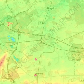
Name: Lehrte topographic map, elevation, terrain.
Location: Lehrte, Region Hannover, Niedersachsen, 31275, Deutschland (52.32204 9.88485 52.43144 10.15632)
Average elevation: 64 m
Minimum elevation: 18 m
Maximum elevation: 146 m
Other topographic maps
Click on a map to view its topography, its elevation and its terrain.
Isernhagen
Deutschland > Niedersachsen > Region Hannover
Isernhagen, Region Hannover, Niedersachsen, Deutschland
Average elevation: 56 m
Hühnenberg
Deutschland > Niedersachsen > Region Hannover > Neustadt am Rübenberge
Hühnenberg, Neustadt am Rübenberge, Region Hannover, Niedersachsen, Deutschland
Average elevation: 48 m