
Thank you for supporting this site ❤️
Make a donation
Make a donation
Gear up for your next adventure:
As an Amazon Associate, this site earns from qualifying purchases at no extra cost to you.
Конска topographic map
Click on the map to display elevation.
Thank you for supporting this site ❤️
Make a donation
Make a donation
Gear up for your next adventure:
As an Amazon Associate, this site earns from qualifying purchases at no extra cost to you.
About this map
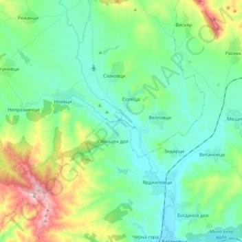
Name: Конска topographic map, elevation, terrain.
Location: Конска, Sopitsa, Breznik, Pernik, Bulgaria (42.60021 22.87151 42.72945 22.95510)
Average elevation: 774 m
Minimum elevation: 656 m
Maximum elevation: 1,125 m
Thank you for supporting this site ❤️
Make a donation
Make a donation
Gear up for your next adventure:
As an Amazon Associate, this site earns from qualifying purchases at no extra cost to you.