
Vincigliata topographic map
Interactive map
Click on the map to display elevation.
About this map
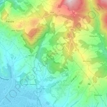
Name: Vincigliata topographic map, elevation, terrain.
Location: Vincigliata, Fiesole, Firenze, Toscane, 50010, Italie (43.77465 11.29559 43.81465 11.33559)
Average elevation: 226 m
Minimum elevation: 57 m
Maximum elevation: 546 m
Other topographic maps
Click on a map to view its topography, its elevation and its terrain.