
Make a donation
Gear up for your next adventure:
As an Amazon Associate, this site earns from qualifying purchases at no extra cost to you.
Miste topographic map
Click on the map to display elevation.
Make a donation
Gear up for your next adventure:
As an Amazon Associate, this site earns from qualifying purchases at no extra cost to you.
Miste
Ten zuiden van Miste loopt de spoorlijn Winterswijk - Zevenaar die eind 19e eeuw is gerealiseerd en door de GOLS werd geëxploiteerd. Ter hoogte van Miste, bij de Halteweg, was er een spoorweghalte voor bewoners uit Miste, te weten halte Miste. Deze is in 1933 gesloten.
Make a donation
Gear up for your next adventure:
As an Amazon Associate, this site earns from qualifying purchases at no extra cost to you.
About this map
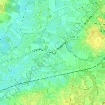
Name: Miste topographic map, elevation, terrain.
Average elevation: 31 m
Minimum elevation: 23 m
Maximum elevation: 45 m
Make a donation
Gear up for your next adventure:
As an Amazon Associate, this site earns from qualifying purchases at no extra cost to you.