
Kumbotso topographic map
Interactive map
Click on the map to display elevation.
About this map
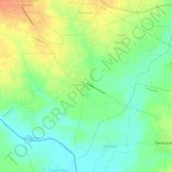
Name: Kumbotso topographic map, elevation, terrain.
Location: Kumbotso, Kano State, Nigeria (11.86428 8.47675 11.91381 8.53563)
Average elevation: 449 m
Minimum elevation: 430 m
Maximum elevation: 474 m
Other topographic maps
Click on a map to view its topography, its elevation and its terrain.