
Ko Klueng Badan topographic map
Interactive map
Click on the map to display elevation.
About this map
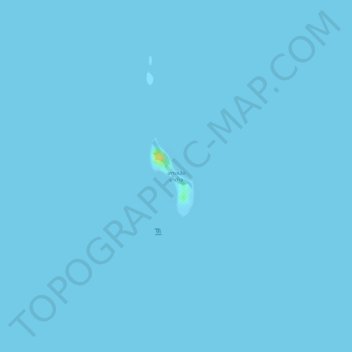
Name: Ko Klueng Badan topographic map, elevation, terrain.
Location: Ko Klueng Badan, Chon Buri Province, Thailand (12.89958 100.67733 12.90593 100.68089)
Average elevation: 0 m
Minimum elevation: -1 m
Maximum elevation: 25 m
Other topographic maps
Click on a map to view its topography, its elevation and its terrain.
Thailand
Thailand comprises several distinct geographic regions, partly corresponding to the provincial groups. The north of the country is the mountainous area of the Thai highlands, with the highest point being Doi Inthanon in the Thanon Thong Chai Range at 2,565 metres (8,415 ft) elevation. The northeast, Isan,…
Average elevation: 156 m
Bangkok
Bangkok is in the Chao Phraya River delta in Thailand's central plain. The river meanders through the city in a southerly direction, emptying into the Gulf of Thailand approximately 25 kilometres (16 mi) south of city centre. The area is flat and low-lying, with an average elevation of 1.5 metres (4 ft 11 in)…
Average elevation: 3 m
Phuket Province
Although some recent geographical works refer to the sections of the Tenasserim Hills in the isthmus as the "Phuket Range", these names are not found in classical geographic sources. Besides, the name Phuket is relatively recent having previously been named Jung Ceylon and Thalang. The highest elevation of the…
Average elevation: 5 m
Ko Pha Ngan
Due to its topography, the population hugs the coastline. The mountainous interior is generally inaccessible. More than half the island designated as national park and Ko Pha-ngan has more than 80 km2 (31 sq mi) of relatively unspoiled rain forest with diverse flora and fauna. It is also considered a spiritual…
Average elevation: 84 m
Bangkok
Bangkok is situated in the Chao Phraya River delta in Thailand's central plain. The river meanders through the city in a southerly direction, emptying into the Gulf of Thailand approximately 25 kilometres (16 mi) south of city centre. The area is flat and low-lying, with an average elevation of 1.5 metres (4…
Average elevation: 3 m
Ban Bang Sao Thong
Thailand > Bang Sao Thong Subdistrict Administrative Organization > Bang Sao Thong Subdistrict
Average elevation: 4 m
Chanthaburi Province
While the southern part of the province is on the shore of the Gulf of Thailand and thus is mostly coastal alluvial plains, the interior of the province is mountainous. The Chanthaburi Mountains in the north has the highest elevation in the province, the 1,675 m high Khao Soi Dao Tai peak. The main river of…
Average elevation: 96 m
Chiang Mai Province
Chiang Mai province is about 685 km (426 mi) from Bangkok in the Mae Ping River basin and is on average at 300 m (1,000 ft) elevation. Surrounded by the mountain ranges of the Thai highlands, it covers an area of approximately 22,135 km2 (9,000 sq mi). The mountains of the Daen Lao Range…
Average elevation: 649 m
Phu Kradung
Phu Kradueng National Park (Thai: อุทยานแห่งชาติภูกระดึง), in the Si Than sub-district of Amphoe Phu Kradueng, Loei Province, is a national park in Thailand. It has a high point of 1,316 m (4318 ft) elevation at Khok Moei. It was proclaimed a national park on 23…
Average elevation: 1,183 m
Bangkok
Bangkok is in the Chao Phraya River delta in Thailand's central plain. The river meanders through the city in a southerly direction, emptying into the Gulf of Thailand approximately 25 kilometres (16 mi) south of city centre. The area is flat and low-lying, with an average elevation of 1.5 metres (4 ft 11 in)…
Average elevation: 3 m
Phuket Province
The island's highest point is traditionally cited as Khao Mai Thao Sip Song, with an altitude of 529 m (1,736 ft) above sea level. However, there are reports suggesting the presence of an unnamed peak in the Kamala Hills, behind Kathu Waterfall, which may reach an elevation of 542 meters above sea level.
Average elevation: 5 m
Ratchaburi Province
The area of Ratchaburi province is divided into three parts. First, the border in the west which is shared with Myanmar and is about 60 kilometres (37 mi) long. The second contains the Tenasserim mountains and forests with an elevation of about 200–300 meters. The central area of the province is rich in…
Average elevation: 274 m