
Gladdenhill topographic map
Interactive map
Click on the map to display elevation.
About this map
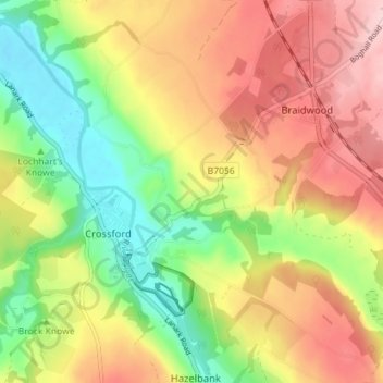
Name: Gladdenhill topographic map, elevation, terrain.
Average elevation: 136 m
Minimum elevation: 40 m
Maximum elevation: 233 m
South Lanarkshire trails, hiking, mountain biking, running and outdoor activities
Other topographic maps
Click on a map to view its topography, its elevation and its terrain.
Craignethan Castle
United Kingdom > Scotland > South Lanarkshire > Crossford > Tillietudlem
Average elevation: 121 m