Geolocate

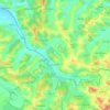
Adalin topographic map

Click on the map to display elevation.

About this map

Name: Adalin topographic map, elevation, terrain.

Location: Adalin, Dragu, Sălaj, 457131, Romania (46.99206 23.41664 47.03206 23.45664)

Average elevation: 401 m

Minimum elevation: 294 m

Maximum elevation: 537 m

Other topographic maps

Click on a map to view its topography, its elevation and its terrain.

Ip

Romania > Sălaj

Average elevation: 236 m

Crasna

Romania > Sălaj

Average elevation: 301 m

Jibou

Romania > Sălaj

Average elevation: 270 m

Zalău

Romania > Sălaj

The city includes a total surface of 90.09 km2 (34.78 sq mi). This includes the one village it administers, Stâna (Felsőnyárló), situated south-east of Meseș, in the hydrographic basin of the Agrij River. Măgura Stânii is at an altitude of 716 m (2,349 ft).

Average elevation: 346 m

Mirșid

Romania > Sălaj

Average elevation: 328 m

Nușfalău

Romania > Sălaj

Average elevation: 259 m

Zalău

Romania > Sălaj

The city includes a total surface of 90.09 km2 (34.78 sq mi). This includes the one village it administers, Stâna (Felsőnyárló), situated south-east of Meseș, in the hydrographic basin of the Agrij River. Măgura Stânii is at an altitude of 716 m (2,349 ft).

Average elevation: 317 m
Treznea

Romania > Sălaj

The commune is situated in the foothills of the Meseș Mountains, at an altitude of 304 m (997 ft), on the banks of the river Treznea. It is located in the central-south part of Sălaj County, at a distance of 14 km (8.7 mi) from the county seat, Zalău.

Average elevation: 385 m

Camăr

Romania > Sălaj

Average elevation: 251 m

Marca

Romania > Sălaj

Average elevation: 244 m

Meseșenii de Jos

Romania > Sălaj

Average elevation: 335 m

Hereclean

Romania > Sălaj

Average elevation: 267 m

Bic

Romania > Sălaj

Average elevation: 318 m

Halmășd

Romania > Sălaj

Average elevation: 382 m

Almașu

Romania > Sălaj

Average elevation: 433 m

Gear up for your next adventure:

🌄Outdoor Binoculars - Compact binoculars for landscape observation
🛰️Handheld GPS Devices - Reliable GPS units for hiking and outdoor navigation
🎒Hiking Backpacks - Comfortable backpacks for day hikes and multi-day treks
📻Hand-Crank Emergency Radios - Stay updated on weather warnings in remote areas
🧭Professional Hiking Compasses - High-precision liquid-filled compasses for map reading and orientation

As an Amazon Associate, this site earns from qualifying purchases at no extra cost to you.