
Make a donation
Gear up for your next adventure:
As an Amazon Associate, this site earns from qualifying purchases at no extra cost to you.
Anaikkattu topographic map
Click on the map to display elevation.
Make a donation
Gear up for your next adventure:
As an Amazon Associate, this site earns from qualifying purchases at no extra cost to you.
About this map
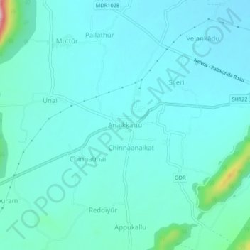
Name: Anaikkattu topographic map, elevation, terrain.
Average elevation: 272 m
Minimum elevation: 241 m
Maximum elevation: 474 m
Make a donation
Gear up for your next adventure:
As an Amazon Associate, this site earns from qualifying purchases at no extra cost to you.
Other topographic maps
Click on a map to view its topography, its elevation and its terrain.
Vellore Fort
India > Tamil Nadu > Vellore > Vellore
It is mentioned that "there is no such fort on the face of earth like the one in Vellore. It had a deep wet ditch (moat) where once 10,000 crocodiles swarmed, waiting to grab every intruder into this impregnable fort. It has huge double walls with bastions projecting irregularly, where two carts can be driven…
Average elevation: 214 m