
Make a donation
Gear up for your next adventure:
As an Amazon Associate, this site earns from qualifying purchases at no extra cost to you.
Monterredondo topographic map
Click on the map to display elevation.
Make a donation
Gear up for your next adventure:
As an Amazon Associate, this site earns from qualifying purchases at no extra cost to you.
About this map
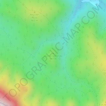
Name: Monterredondo topographic map, elevation, terrain.
Average elevation: 875 m
Minimum elevation: 665 m
Maximum elevation: 1,302 m
Make a donation
Gear up for your next adventure:
As an Amazon Associate, this site earns from qualifying purchases at no extra cost to you.
Other topographic maps
Click on a map to view its topography, its elevation and its terrain.
01420
Spain > Autonomous Community of the Basque Country > Añanako kuadrilla/Cuadrilla de Añana > Castillo Sopeña
Average elevation: 660 m
Nanclares de la Oca/Langraiz Oka
Spain > Autonomous Community of the Basque Country > Añanako kuadrilla/Cuadrilla de Añana
Average elevation: 613 m
Armiñón
Spain > Autonomous Community of the Basque Country > Añanako kuadrilla/Cuadrilla de Añana
Average elevation: 520 m