
Busoba topographic map
Interactive map
Click on the map to display elevation.
About this map
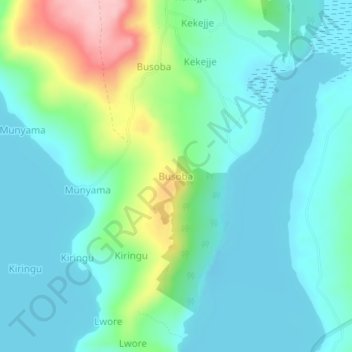
Name: Busoba topographic map, elevation, terrain.
Location: Busoba, Buvuma, Central Region, Uganda (0.11325 33.27416 0.15325 33.31416)
Average elevation: 1,174 m
Minimum elevation: 1,131 m
Maximum elevation: 1,319 m
Other topographic maps
Click on a map to view its topography, its elevation and its terrain.