
Tinto topographic map
Interactive map
Click on the map to display elevation.
About this map
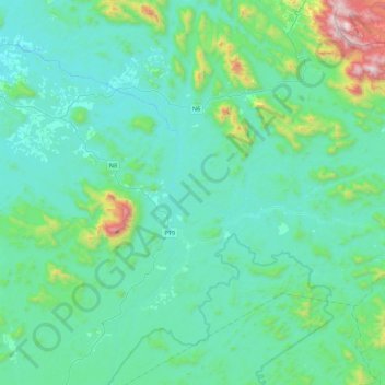
Name: Tinto topographic map, elevation, terrain.
Location: Tinto, Manyu, Southwest, Cameroon (5.38609 9.50811 5.82345 9.91511)
Average elevation: 277 m
Minimum elevation: 75 m
Maximum elevation: 1,480 m
Other topographic maps
Click on a map to view its topography, its elevation and its terrain.