
Santa Pau topographic map
Interactive map
Click on the map to display elevation.
About this map
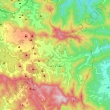
Name: Santa Pau topographic map, elevation, terrain.
Location: Santa Pau, Garrotxa, Gerona, Catalonië, 17811, Spanje (42.11366 2.49372 42.19442 2.62966)
Average elevation: 545 m
Minimum elevation: 213 m
Maximum elevation: 1,004 m
Other topographic maps
Click on a map to view its topography, its elevation and its terrain.
Sant Feliu de Pallerols
Sant Feliu de Pallerols, Garrotxa, Gerona, Catalonië, 17174, Spanje
Average elevation: 642 m