Geolocate

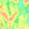
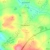
Springmount topographic map

Click on the map to display elevation.

About this map

Name: Springmount topographic map, elevation, terrain.

Location: Springmount, Killann ED, New Ross Municipal District, The Municipal District of New Ross, County Wexford, Leinster, Ireland (52.53346 -6.78915 52.54621 -6.75017)

Average elevation: 181 m

Minimum elevation: 84 m

Maximum elevation: 381 m

Other topographic maps

Click on a map to view its topography, its elevation and its terrain.
Gear up for your next adventure:

🗺️Scratch-off Peak Maps - Track your progress climbing Munros or Wainwrights
📍Handheld GPS Navigators - Reliable satellite navigation for hiking and off-road exploration
👖Convertible Hiking Trousers - Versatile zip-off pants for changing mountain weather conditions
🔋Solar Power Banks - Keep your GPS and phone charged during multi-day expeditions
📸Action Camera Chest Mounts - Record your ascent following topographic paths hands-free

As an Amazon Associate, this site earns from qualifying purchases at no extra cost to you.