
Labutta topographic map
Interactive map
Click on the map to display elevation.
About this map
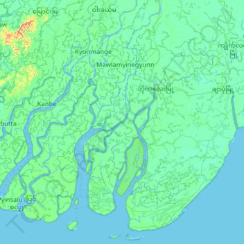
Name: Labutta topographic map, elevation, terrain.
Location: Labutta, Ayeyarwady, 23245, Myanmar (15.70847 94.50484 16.58965 95.53286)
Average elevation: 4 m
Minimum elevation: -4 m
Maximum elevation: 49 m
Other topographic maps
Click on a map to view its topography, its elevation and its terrain.
Ngapudaw
Myanmar > Ayeyarwady > Ngapudaw
Ngapudaw, Pathein, Ayeyarwady, Myanmar
Average elevation: 17 m