
Suna East topographic map
Interactive map
Click on the map to display elevation.
About this map
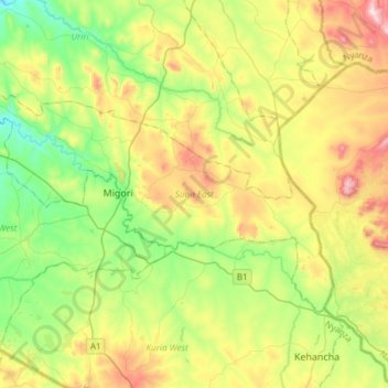
Name: Suna East topographic map, elevation, terrain.
Location: Suna East, Migori County, Nyanza, Kenya (-1.15885 34.33369 -0.97630 34.63270)
Average elevation: 1,464 m
Minimum elevation: 1,249 m
Maximum elevation: 1,832 m
Other topographic maps
Click on a map to view its topography, its elevation and its terrain.