
Nambu-myeon topographic map
Interactive map
Click on the map to display elevation.
About this map
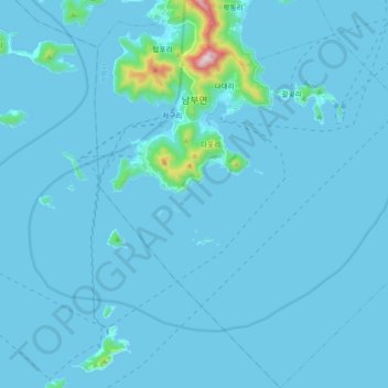
Name: Nambu-myeon topographic map, elevation, terrain.
Location: Nambu-myeon, Geoje-si, South Gyeongsang, South Korea (34.62675 128.56842 34.77663 128.73608)
Average elevation: 22 m
Minimum elevation: -1 m
Maximum elevation: 570 m