
Mondovi topographic map
Interactive map
Click on the map to display elevation.
About this map
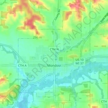
Name: Mondovi topographic map, elevation, terrain.
Location: Mondovi, Buffalo County, Wisconsin, United States (44.55518 -91.69106 44.58965 -91.63006)
Average elevation: 257 m
Minimum elevation: 234 m
Maximum elevation: 307 m
Other topographic maps
Click on a map to view its topography, its elevation and its terrain.