
Make a donation
Gear up for your next adventure:
As an Amazon Associate, this site earns from qualifying purchases at no extra cost to you.
Encañada topographic map
Click on the map to display elevation.
Make a donation
Gear up for your next adventure:
As an Amazon Associate, this site earns from qualifying purchases at no extra cost to you.
Encañada
One of the highest elevations of the district is the Llusk'a Qullpa mountain range at approximately 4,000 m (13,000 ft) on the border with the Namora District. Other mountains are listed below.
Make a donation
Gear up for your next adventure:
As an Amazon Associate, this site earns from qualifying purchases at no extra cost to you.
About this map
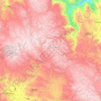
Name: Encañada topographic map, elevation, terrain.
Location: Encañada, Province of Cajamarca, Cajamarca, Peru (-7.16532 -78.60175 -6.79894 -78.18369)
Average elevation: 3,421 m
Minimum elevation: 1,518 m
Maximum elevation: 4,244 m
Make a donation
Gear up for your next adventure:
As an Amazon Associate, this site earns from qualifying purchases at no extra cost to you.
Other topographic maps
Click on a map to view its topography, its elevation and its terrain.