
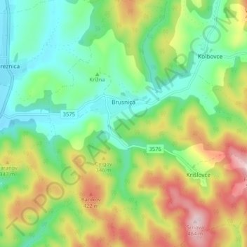
Brusnica topographic map
Interactive map
Click on the map to display elevation.
About this map
Name: Brusnica topographic map, elevation, terrain.
Average elevation: 286 m
Minimum elevation: 172 m
Maximum elevation: 483 m
The municipality lies at an altitude of 199 metres and covers an area of 14.283 km². It has a population of about 415 people. The village has a significant Rusyn minority (32%) and smaller Romani minority (2%), along with the majority of Slovaks (65%).
Other topographic maps
Click on a map to view its topography, its elevation and its terrain.
Stropkov
Slovakia > Region of Prešov > District of Stropkov
Stropkov, District of Stropkov, Region of Prešov, Eastern Slovakia, Slovakia
Average elevation: 265 m