Geolocate

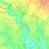
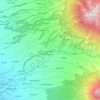
Secang topographic map

Click on the map to display elevation.

About this map

Name: Secang topographic map, elevation, terrain.

Location: Secang, Magelang, Central Java, Java, 56195, Indonesia (-7.43191 110.20665 -7.35191 110.28665)

Average elevation: 477 m

Minimum elevation: 345 m

Maximum elevation: 649 m

Other topographic maps

Click on a map to view its topography, its elevation and its terrain.
Muntilan

Indonesia > Central Java > Magelang

Average elevation: 296 m

Salam

Indonesia > Central Java > Magelang

Average elevation: 284 m

Sungai Progo

Indonesia > Central Java > Magelang > Mungkid

Average elevation: 232 m

Ngluwar

Indonesia > Central Java > Magelang

Average elevation: 242 m

Adikarto

Indonesia > Central Java > Magelang > Tanjung

Average elevation: 245 m

Dukun

Indonesia > Central Java > Magelang

Average elevation: 911 m

Sawangan

Indonesia > Central Java > Magelang

Average elevation: 1,299 m

Srumbung

Indonesia > Central Java > Magelang

Average elevation: 764 m

Gear up for your next adventure:

🚲Cycling GPS Computers - Track elevation and topographic routes on two wheels
🛌Insulated Sleeping Mats - Crucial thermal protection when sleeping on cold, uneven ground
🔦Outdoor Torches - Reliable torches for night navigation
🥾Women's Waterproof Hiking Boots - High-performance trekking boots designed for all-weather comfort
🎒Hiking Daypacks (20L) - Compact backpacks for day trips and technical mountain ascents

As an Amazon Associate, this site earns from qualifying purchases at no extra cost to you.