
Konongo topographic map
Interactive map
Click on the map to display elevation.
About this map
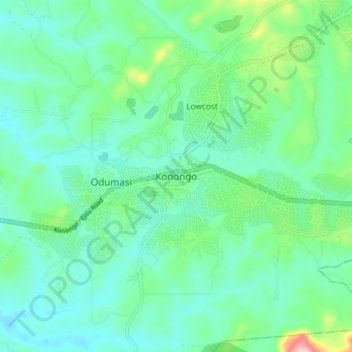
Name: Konongo topographic map, elevation, terrain.
Average elevation: 232 m
Minimum elevation: 181 m
Maximum elevation: 414 m
Other topographic maps
Click on a map to view its topography, its elevation and its terrain.
Asante-Akim Central Municipal District
Ghana > Ashanti Region > Asante-Akim Central Municipal District
Average elevation: 233 m