Geolocate

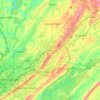
Eastpointe topographic map

Click on the map to display elevation.

About this map

Name: Eastpointe topographic map, elevation, terrain.

Location: Eastpointe, Birmingham, Jefferson County, Alabama, 35217, United States (33.57288 -86.75666 33.61288 -86.71666)

Average elevation: 216 m

Minimum elevation: 128 m

Maximum elevation: 265 m

Other topographic maps

Click on a map to view its topography, its elevation and its terrain.
Gear up for your next adventure:

📕Outdoor Navigation Books - Learn traditional and modern navigation techniques
💧Hydration Reservoirs - Convenient water bladders for hands-free drinking on the move
🔥Reusable Hand Warmers - Maintain dexterity in your fingers for precise map handling
🛰️Handheld GPS Devices - Reliable GPS units for hiking and outdoor navigation
👟Heavy Duty Boot Laces - Always carry a spare for your hiking footwear

As an Amazon Associate, this site earns from qualifying purchases at no extra cost to you.