
Grafton topographic map
Interactive map
Click on the map to display elevation.
About this map
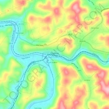
Name: Grafton topographic map, elevation, terrain.
Location: Grafton, Taylor County, West Virginia, 26354, United States (39.32237 -80.04376 39.35839 -79.98390)
Average elevation: 376 m
Minimum elevation: 289 m
Maximum elevation: 486 m
Other topographic maps
Click on a map to view its topography, its elevation and its terrain.