
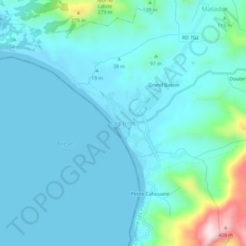
Les Irois topographic map
Interactive map
Click on the map to display elevation.
About this map
Name: Les Irois topographic map, elevation, terrain.
Average elevation: 57 m
Minimum elevation: 0 m
Maximum elevation: 422 m
Other topographic maps
Click on a map to view its topography, its elevation and its terrain.
Grand Bassin
Haiti > Département de la Grande-Anse > Commune Les Irois > Les Irois > Grand Bassin
Average elevation: 95 m