Geolocate

Barabar topographic map

Click on the map to display elevation.

About this map

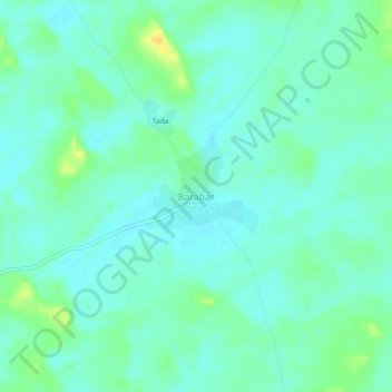
Name: Barabar topographic map, elevation, terrain.

Location: Barabar, Sujangarh Tehsil, Churu, Rajasthan, India (27.76419 74.54975 27.80419 74.58975)

Average elevation: 328 m

Minimum elevation: 320 m

Maximum elevation: 346 m

Gear up for your next adventure:

🔥Emergency Fire Starters - Reliable ignition tools for survival situations in damp conditions
🥾Hiking Boots - Waterproof and durable boots for long-distance hiking in the UK
🧤Thermal Touchscreen Gloves - Stay warm while operating your GPS or smartphone camera
📍Handheld GPS Navigators - Reliable satellite navigation for hiking and off-road exploration
🥫Expedition Meals - Lightweight, high-calorie nutrition for long-distance hikers

As an Amazon Associate, this site earns from qualifying purchases at no extra cost to you.