Geolocate

Edakkunnam topographic map

Click on the map to display elevation.

About this map

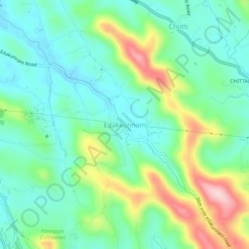
Name: Edakkunnam topographic map, elevation, terrain.

Location: Edakkunnam, Kanjirappally, Kottayam, Kerala, 686512, India (9.52905 76.82026 9.56905 76.86026)

Average elevation: 126 m

Minimum elevation: 55 m

Maximum elevation: 292 m

Other topographic maps

Click on a map to view its topography, its elevation and its terrain.

Cheruvally Estate

India > Kerala > Kanjirappally > Charuveli

Average elevation: 101 m

Bhoothakulam

India > Kerala > Kanjirappally > Panamattam

Average elevation: 121 m

Gear up for your next adventure:

🦶Anti-Blister Balms - Protect your feet before long topographic expeditions
🔦Head Torches - Hands-free lighting for hiking and camping
🥫Expedition Meals - Lightweight, high-calorie nutrition for long-distance hikers
🍳Camping Stoves - Compact stoves for outdoor cooking
🧺Microfibre Travel Towels - Fast-drying and compact towels for wild swimming and camping

As an Amazon Associate, this site earns from qualifying purchases at no extra cost to you.