Cap de Ruhos topographic map
Interactive map
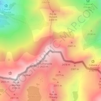
Click on the map to display elevation.
About this map
Name: Cap de Ruhos topographic map, elevation, terrain.
Average elevation: 2,164 m
Minimum elevation: 1,442 m
Maximum elevation: 2,649 m

Click on the map to display elevation.
Name: Cap de Ruhos topographic map, elevation, terrain.
Average elevation: 2,164 m
Minimum elevation: 1,442 m
Maximum elevation: 2,649 m