
Thank you for supporting this site ❤️
Make a donation
Make a donation
Gear up for your next adventure:
As an Amazon Associate, this site earns from qualifying purchases at no extra cost to you.
Barbastro topographic map
Click on the map to display elevation.
Thank you for supporting this site ❤️
Make a donation
Make a donation
Gear up for your next adventure:
As an Amazon Associate, this site earns from qualifying purchases at no extra cost to you.
About this map
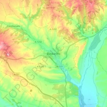
Name: Barbastro topographic map, elevation, terrain.
Location: Barbastro, Somontano de Barbastro, Huesca, Aragon, 22300, Spain (41.97537 0.03734 42.09806 0.20407)
Average elevation: 389 m
Minimum elevation: 274 m
Maximum elevation: 580 m
Thank you for supporting this site ❤️
Make a donation
Make a donation
Gear up for your next adventure:
As an Amazon Associate, this site earns from qualifying purchases at no extra cost to you.