
Thank you for supporting this site ❤️
Make a donation
Make a donation
Gear up for your next adventure:
As an Amazon Associate, this site earns from qualifying purchases at no extra cost to you.
Carsehill topographic map
Click on the map to display elevation.
Thank you for supporting this site ❤️
Make a donation
Make a donation
Gear up for your next adventure:
As an Amazon Associate, this site earns from qualifying purchases at no extra cost to you.
About this map
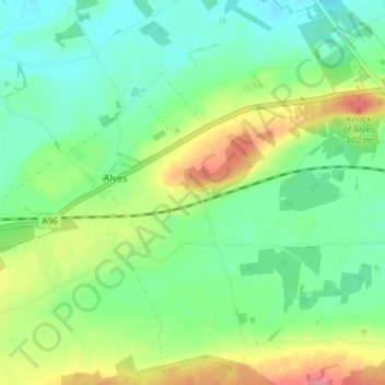
Name: Carsehill topographic map, elevation, terrain.
Location: Carsehill, Alves, Moray, Scotland, IV30 8XF, United Kingdom (57.62003 -3.45633 57.66003 -3.41633)
Average elevation: 36 m
Minimum elevation: 6 m
Maximum elevation: 94 m
Moray trails, hiking, mountain biking, running and outdoor activities
Thank you for supporting this site ❤️
Make a donation
Make a donation
Gear up for your next adventure:
As an Amazon Associate, this site earns from qualifying purchases at no extra cost to you.