
Larbatache topographic map
Interactive map
Click on the map to display elevation.
About this map
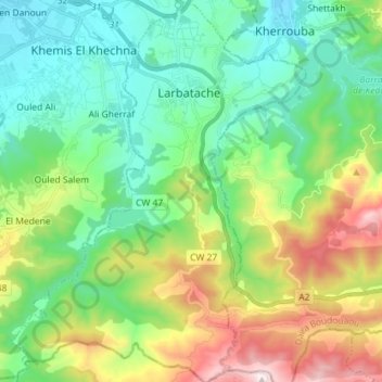
Name: Larbatache topographic map, elevation, terrain.
Average elevation: 342 m
Minimum elevation: 46 m
Maximum elevation: 1,032 m
Other topographic maps
Click on a map to view its topography, its elevation and its terrain.
Ouled Moussa
Algeria > Boumerdès > Khemis El Khechna District > Ouled Moussa > Ouled Moussa
Ouled Moussa, Khemis El Khechna District, Boumerdes, 35012, Algeria
Average elevation: 77 m
Khemis El Khechna
Algeria > Boumerdès > Khemis El Khechna District > Khemis El Khechna
Khemis El Khechna, Khemis El Khechna District, Boumerdès, 35010, Algeria
Average elevation: 237 m