Geolocate

Seneca Rocks topographic map

Click on the map to display elevation.

About this map

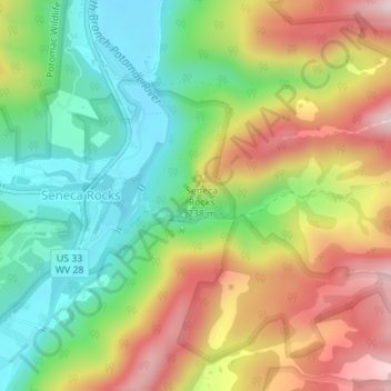
Name: Seneca Rocks topographic map, elevation, terrain.

Location: Seneca Rocks, Pendleton County, West Virginia, United States (38.83311 -79.36746 38.83627 -79.36525)

Average elevation: 623 m

Minimum elevation: 453 m

Maximum elevation: 845 m

Gear up for your next adventure:

🎒Hiking Daypacks (20L) - Compact backpacks for day trips and technical mountain ascents
🗺️Ordnance Survey Maps - Official UK maps for walking and outdoor activities
📍Handheld GPS Navigators - Reliable satellite navigation for hiking and off-road exploration
🖼️Topographic Map Art - Decorative 3D-effect posters of famous UK peaks and regions
🥤Hiking Water Bottles - Reusable bottles for hydration on the trail

As an Amazon Associate, this site earns from qualifying purchases at no extra cost to you.