
太秦和泉式部町 topographic map
Interactive map
Click on the map to display elevation.
About this map
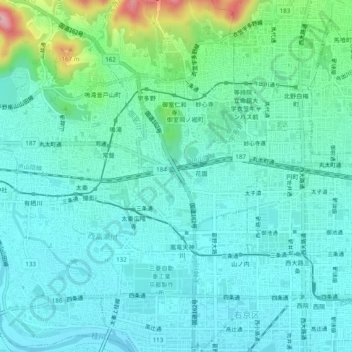
Name: 太秦和泉式部町 topographic map, elevation, terrain.
Location: 太秦和泉式部町, 右京区, 京都市, 京都府, 616-8227, 日本 (34.99725 135.69416 35.03725 135.73416)
Average elevation: 55 m
Minimum elevation: 20 m
Maximum elevation: 202 m