Geolocate

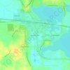
Syracuse topographic map

Click on the map to display elevation.

About this map

Name: Syracuse topographic map, elevation, terrain.

Location: Syracuse, Kosciusko County, Indiana, United States (41.40303 -85.76861 41.43607 -85.73412)

Average elevation: 267 m

Minimum elevation: 257 m

Maximum elevation: 283 m

Other topographic maps

Click on a map to view its topography, its elevation and its terrain.

Gear up for your next adventure:

🧤Thermal Touchscreen Gloves - Stay warm while operating your GPS or smartphone camera
📱Phone Mounts for Hiking - Secure mounts to carry your phone on trails
🧭GPS Trackers - Tracking devices for safety and navigation
🧢Hiking Hats - Sun and weather protection for outdoor walks
👟Women's Trail Running Shoes - Agile footwear for fell running and technical trails

As an Amazon Associate, this site earns from qualifying purchases at no extra cost to you.