
Les Issartoux topographic map
Interactive map
Click on the map to display elevation.
About this map
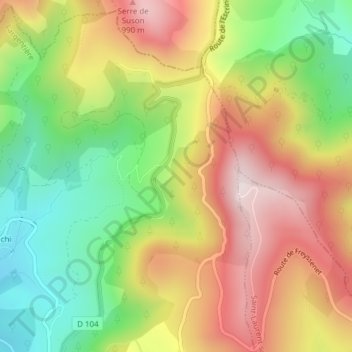
Name: Les Issartoux topographic map, elevation, terrain.
Average elevation: 741 m
Minimum elevation: 480 m
Maximum elevation: 1,013 m
Other topographic maps
Click on a map to view its topography, its elevation and its terrain.
Les Plagnols
France > Auvergne-Rhône-Alpes > Saint-Étienne-de-Boulogne
Les Plagnols, Saint-Étienne-de-Boulogne, Largentière, Ardèche, Auvergne-Rhône-Alpes, France métropolitaine, 07200, France
Average elevation: 494 m