Geolocate

Ellada topographic map

Click on the map to display elevation.

About this map

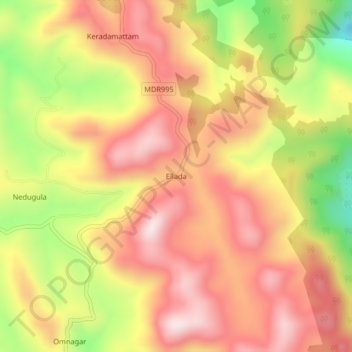
Name: Ellada topographic map, elevation, terrain.

Location: Ellada, Kotagiri, Nilgiris District, Tamil Nadu, 643216, India (11.45867 76.88750 11.49867 76.92750)

Average elevation: 1,910 m

Minimum elevation: 1,606 m

Maximum elevation: 2,115 m

Gear up for your next adventure:

💧Hydration Reservoirs - Convenient water bladders for hands-free drinking on the move
🧭Professional Hiking Compasses - High-precision liquid-filled compasses for map reading and orientation
🥾Walking Shoes - Lightweight walking shoes for countryside and coastal paths
🌦️Portable Weather Meters - Handheld tools for monitoring weather conditions
🗺️Ordnance Survey Maps - Official UK maps for walking and outdoor activities

As an Amazon Associate, this site earns from qualifying purchases at no extra cost to you.