Geolocate

Niyari topographic map

Click on the map to display elevation.

About this map

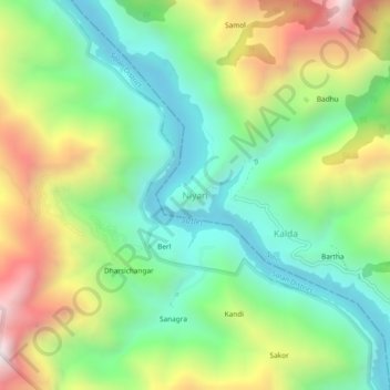
Name: Niyari topographic map, elevation, terrain.

Location: Niyari, Nihri, Mandi District, Himachal Pradesh, India (31.31538 76.92558 31.35538 76.96558)

Average elevation: 977 m

Minimum elevation: 546 m

Maximum elevation: 1,720 m

Gear up for your next adventure:

Camping Shelters - Emergency and lightweight shelters for outdoor use
🖼️Topographic Map Art - Decorative 3D-effect posters of famous UK peaks and regions
🧣Neck Gaiters - Protects against wind and sun on exposed ridges and peaks
🧭GPS Trackers - Tracking devices for safety and navigation
🩹Hiking First Aid Kits - Compact medical kits tailored for trail injuries and emergencies

As an Amazon Associate, this site earns from qualifying purchases at no extra cost to you.