
Thank you for supporting this site ❤️
Make a donation
Make a donation
Gear up for your next adventure:
As an Amazon Associate, this site earns from qualifying purchases at no extra cost to you.
Kanipakam topographic map
Click on the map to display elevation.
Thank you for supporting this site ❤️
Make a donation
Make a donation
Gear up for your next adventure:
As an Amazon Associate, this site earns from qualifying purchases at no extra cost to you.
About this map
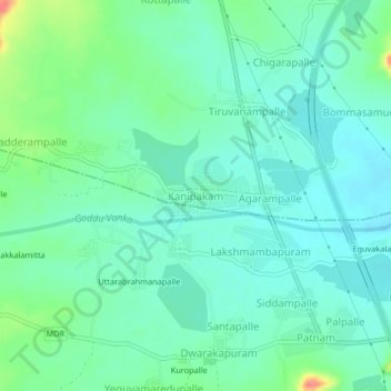
Name: Kanipakam topographic map, elevation, terrain.
Location: Kanipakam, Irala, Chittoor, Andhra Pradesh, 517131, India (13.25703 79.01500 13.29703 79.05500)
Average elevation: 339 m
Minimum elevation: 321 m
Maximum elevation: 392 m
Thank you for supporting this site ❤️
Make a donation
Make a donation
Gear up for your next adventure:
As an Amazon Associate, this site earns from qualifying purchases at no extra cost to you.