
Somaram topographic map
Interactive map
Click on the map to display elevation.
About this map
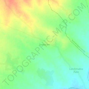
Name: Somaram topographic map, elevation, terrain.
Average elevation: 417 m
Minimum elevation: 397 m
Maximum elevation: 443 m
Other topographic maps
Click on a map to view its topography, its elevation and its terrain.
Doodi Venkatapur
India > Telangana > Rajapeta mandal > Doodi Venkatapur
Doodi Venkatapur, Rajapeta mandal, Yadadri Bhuvanagiri, Telangana, 508105, India
Average elevation: 413 m
Pamukunta
India > Telangana > Rajapeta mandal > Pamukunta
Pamukunta, Rajapeta mandal, Yadadri Bhuvanagiri, Telangana, India
Average elevation: 483 m