
Thank you for supporting this site ❤️
Make a donation
Make a donation
Gear up for your next adventure:
As an Amazon Associate, this site earns from qualifying purchases at no extra cost to you.
Gatab topographic map
Click on the map to display elevation.
Thank you for supporting this site ❤️
Make a donation
Make a donation
Gear up for your next adventure:
As an Amazon Associate, this site earns from qualifying purchases at no extra cost to you.
About this map
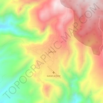
Name: Gatab topographic map, elevation, terrain.
Location: Gatab, Loiyangalani ward, Marsabit County, Eastern, Kenya (2.62455 36.91125 2.66455 36.95125)
Average elevation: 1,610 m
Minimum elevation: 1,212 m
Maximum elevation: 1,942 m
Thank you for supporting this site ❤️
Make a donation
Make a donation
Gear up for your next adventure:
As an Amazon Associate, this site earns from qualifying purchases at no extra cost to you.