Geolocate

Bassa topographic map

Click on the map to display elevation.

About this map

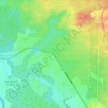
Name: Bassa topographic map, elevation, terrain.

Location: Bassa, Dibombari, Moungo, Littoral, Cameroon (4.12689 9.54860 4.16689 9.58860)

Average elevation: 22 m

Minimum elevation: -1 m

Maximum elevation: 53 m

Gear up for your next adventure:

🥫Expedition Meals - Lightweight, high-calorie nutrition for long-distance hikers
📍Handheld GPS Navigators - Reliable satellite navigation for hiking and off-road exploration
🧢Waterproof Hiking Hats - Keep the rain off your face while studying topographic maps
🧷Tenacious Repair Tape - Instant fix for torn tents, jackets, or dry bags
📱Rugged Phone Cases - Heavy-duty protection for smartphones used as secondary GPS tools

As an Amazon Associate, this site earns from qualifying purchases at no extra cost to you.