Geolocate

Spring Valley topographic map

Click on the map to display elevation.

About this map
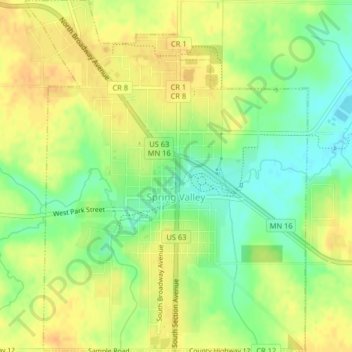
Name: Spring Valley topographic map, elevation, terrain.

Location: Spring Valley, Fillmore County, Minnesota, United States (43.67420 -92.40659 43.70331 -92.37415)

Average elevation: 400 m

Minimum elevation: 381 m

Maximum elevation: 413 m

Other topographic maps

Click on a map to view its topography, its elevation and its terrain.

Gear up for your next adventure:

🛑Emergency Bivvy Bags - Heat-reflective survival bags for unexpected nights out
🛰️Satellite Messengers - Emergency communication devices for areas without mobile signal
🔦Waterproof LED Headlamps - Hands-free lighting for evening treks and emergency navigation
❄️Walking Crampons - Added traction for icy slopes and winter peak bagging
👟Women's Trail Running Shoes - Agile footwear for fell running and technical trails

As an Amazon Associate, this site earns from qualifying purchases at no extra cost to you.