
Barrage Bin el Ouidane topographic map
Interactive map
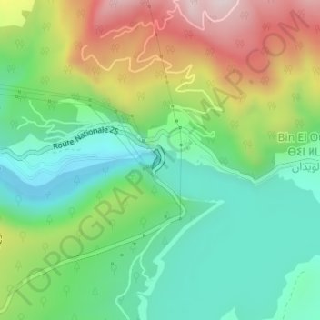
Click on the map to display elevation.
About this map
Name: Barrage Bin el Ouidane topographic map, elevation, terrain.
Average elevation: 927 m
Minimum elevation: 707 m
Maximum elevation: 1,313 m
Other topographic maps
Click on a map to view its topography, its elevation and its terrain.
Bin El Ouidane
Maroc > cercle d'Ouaouizeght > Bin El Ouidane
Bin El Ouidane, caïdat d'Ouaouizeght, cercle d'Ouaouizeght, Province d'Azilal, Béni Mellal-Khénifra, 22202, Maroc
Average elevation: 967 m