Geolocate

Kudat topographic map

Click on the map to display elevation.

About this map

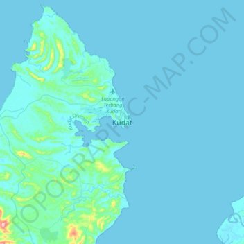
Name: Kudat topographic map, elevation, terrain.

Location: Kudat, Kudat Division, Sabah, 89050, Malaysia (6.72303 116.68938 7.04303 117.00938)

Average elevation: 19 m

Minimum elevation: -1 m

Maximum elevation: 391 m

Other topographic maps

Click on a map to view its topography, its elevation and its terrain.

Pulau Mandidarah

Malaysia > Sabah > Kudat

Average elevation: 0 m

Gear up for your next adventure:

🧥Softshell Jackets - Breathable jackets for active outdoor use
Lightweight Tents - Compact tents for backpacking and trekking
❄️Walking Crampons - Added traction for icy slopes and winter peak bagging
Camping Shelters - Emergency and lightweight shelters for outdoor use
🧷Tenacious Repair Tape - Instant fix for torn tents, jackets, or dry bags

As an Amazon Associate, this site earns from qualifying purchases at no extra cost to you.